
|
|
|
National Weather Service issues Winter Storm Watch for upper country National Weather Service-Missoula has issued a Winter Storm Watch for the Northern and Southern Clearwater Mountains from Thursday night through Saturday afternoon. Heavy mixed precipitation is possible. There is a chance of moderate to major winter weather impacts. Total snow accumulations of 3 to 7 inches along valley bottoms, 7 to 15 inches at mountain pass level, and 24 to 36 inches along mountain crests. Ice accumulations around a light glaze possible. Areas of particular note in Idaho include the Northern and Southern Clearwater Mountains; and in Montana, West Glacier Region, Bitterroot/Sapphire Mountains, Lower Clark Fork Region, and Potomac/Seeley Lake Region. Travel could be very difficult to impossible. The hazardous conditions could impact the Friday morning and evening commutes, especially over higher passes. Precautionary/Preparedness Actions Monitor the latest forecasts for updates on this situation. 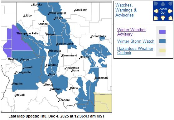 Pierce, at elevation 3,085 feet Thursday: Snow, mainly after 9 a.m. Patchy fog before 9 a.m. High near 33. Calm wind. Chance of precipitation is 90%. New snow accumulation of 2 to 4 inches possible. Thursday night: Rain and snow, possibly mixed with freezing rain before 2 a.m., then snow, possibly mixed with freezing rain between 2 a.m. and 3 a.m., then rain and snow, possibly mixed with freezing rain after 3 a.m. Patchy fog. Snow level 3,800 feet. Low around 28. Calm wind. Chance of precipitation is 90%. Little or no ice accumulation expected. New snow accumulation of 1 to 2 inches possible. Friday: Rain and snow, possibly mixed with freezing rain before 7 a.m., then rain, possibly mixed with snow. Snow level 4,300 feet rising to 5,000 feet. High near 38. Calm wind becoming southwest around 6 mph in the afternoon. Chance of precipitation is 100%. New snow accumulation of less than a half inch possible. Friday night: Rain, possibly mixed with snow before 10 p.m., then rain, possibly mixed with snow and freezing rain. Low around 31. West southwest wind 3 to 5 miles per hour. Chance of precipitation is 100%. Little or no snow accumulation expected. Saturday: Rain, possibly mixed with freezing rain, becoming all rain after 7 a.m. Snow level 4,300 feet. High near 38. Chance of precipitation is 90%. New precipitation amounts between a quarter and half of an inch possible. 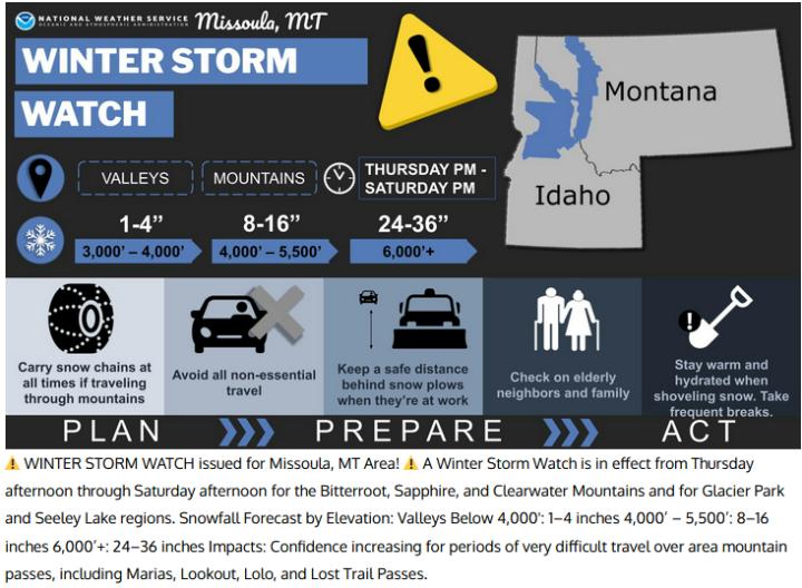  |
| Window on the Clearwater P.O. Box 2444 Orofino, ID 83544 Phone: (208) 476-0733 Fax: (208) 476-4140 |