
|
|
|
National Weather Service issues Winter Weather Advisory for Clearwater County National Weather Service-Missoula is forecasting widespread winter weather with wind impacts for Clearwater County and surrounding areas. The advisory is from 7 a.m. Friday to 1 p.m. Saturday for the Northern Clearwater Mountains and from 4 p.m. to 10 a.m. for the Orofino/Grangeville Region. 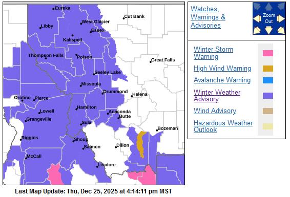 Northern Clearwater Mountains A series of cold fronts will move through the Northern Rockies bringing wind and snow impacts beginning as early as late Thursday night into Friday morning. Snow squalls are possible in west-central and southwest Montana late Friday night into early Saturday morning. A push of Arctic air will move westward across the Continental Divide on Saturday bringing another uptick and change in direction of winds with much colder temperatures to follow. Snow is expected. There is a likelihood of moderate winter weather impacts. Total snow accumulations between 2 and 7 inches with winds gusting as high as 45 miles per hour are possible. Areas of particular impact include State Highway 11 Pierce to Headquarters, Pierce, and Elk River. For moderate winter weather impacts, expect disruptions to normal activities. Hazardous traveling conditions. Use extra caution while driving. The hazardous conditions could impact the Friday morning and evening commutes, especially over higher passes. There is the potential for a rapid freeze up of wet or slushy surfaces with much colder air moving into the area on Saturday. Precautionary/Preparedness Actions: Slow down and use caution while traveling. The latest road conditions can be obtained by calling 5 1 1. Pierce, elevation 3,085 feet Thursday night: Rain before 5 a.m., then rain, possibly mixed with snow. Some thunder is also possible. Areas of fog. Low around 32. Calm wind. Chance of precipitation is 80%. Little or no snow accumulation expected. Friday: Rain and snow. Snow level 4,100 feet lowering to 3,400 feet in the afternoon . High near 39. South southwest wind 10 to 20 mph, with gusts as high as 29 mph. Chance of precipitation is 90%. New snow accumulation of less than a half inch possible. Friday night: Rain and snow, becoming all snow after 7 p.m. Low around 24. West southwest wind 13 to 16 mph, with gusts as high as 34 mph. Chance of precipitation is 100%. New snow accumulation of 3 to 5 inches possible. Saturday: Snow, mainly before 10 a.m. High near 28. West wind 8 to 10 mph. Chance of precipitation is 90%. New snow accumulation of 1 to 3 inches possible. Saturday night: Patchy fog before 2am, then patchy fog after 5am. Otherwise, partly cloudy, with a low around 12. Orofino/Grangeville Region A series of cold fronts will move through the Northern Rockies bringing wind and snow impacts beginning as early as late tonight into Friday morning. Snow squalls are possible in west-central and southwest Montana late Friday night into early Saturday morning. A push of Arctic air will move westward across the Continental Divide on Saturday bringing another uptick and change in direction of winds with much colder temperatures to follow. Snow is expected. There is a likelihood of minor to moderate winter weather impacts. Total snow accumulations between 1 and 3 inches. Winds gusting as high as 55 mph. Areas of particular impact include Greer Grade, Grangeville and vicinity, and Camas Prairie. For moderate winter weather impacts, expect disruptions to normal activities. Hazardous traveling conditions. Use extra caution while driving. The hazardous conditions could impact the Friday evening commute, especially over higher passes. Gusty winds could bring down tree branches. Temperatures will drop through the 20s on Saturday. Blowing and drifting of any accumulated snow, or active snowfall, will be possible. Rapid freeze up of any wet or slushy surfaces is possible. Precautionary/Preparedness Actions: Slow down and use caution while traveling. The latest road conditions can be obtained by calling 5 1 1. Orofino, elevation 1,039 feet Thursday night: Rain, mainly after 4 a.m. Low around 35. South wind around 7 mph. Chance of precipitation is 80%. New precipitation amounts of less than a tenth of an inch possible. Friday: Rain before 10 a.m., then rain and snow likely. Snow level 4,500 feet lowering to 3,200 feet in the afternoon. High near 40. South southeast wind 6 to 11 mph becoming south 16 to 21 mph in the afternoon. Winds could gust as high as 30 mph. Chance of precipitation is 80%. Little or no snow accumulation expected. Friday night: Rain and snow, becoming all snow after 11 p.m. Patchy blowing snow after 4 a.m. Low around 27. South wind 15 to 21 mph becoming west after midnight. Winds could gust as high as 38 mph. Chance of precipitation is 100%. New snow accumulation of 1 to 2 inches possible. Saturday: Snow, mainly before 11 a.m. Patchy blowing snow before 11 a.m. High near 29. West wind 11 to 20 mph, with gusts as high as 28 mph. Chance of precipitation is 80%. New snow accumulation of less than one inch possible.   |
| Window on the Clearwater P.O. Box 2444 Orofino, ID 83544 Phone: (208) 476-0733 Fax: (208) 476-4140 |